|
Conocchia e Molare Forestale > Conocchia > Molare
|
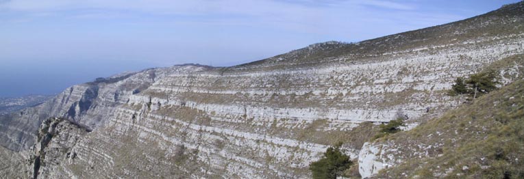
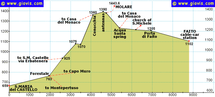
Questa è senz'altro una delle più belle escursioni della Penisola, anche se solo poche volte nel corso dell'anno si verificano tutte le condizioni per renderla perfetta (soprattutto temperatura e visibilità). A me piace effettuare quest'escursione come un circuito da Moiano: S. Maria del Castello, Forestale, la ripida salita alla Conocchia e poi, dopo il Molare, discesa fino al piazzale della seggiovia passando per Porta di Faito. Si rientra a Moiano o a Vico con il bus della Circumvesuviana, o a Castellammare con la seggiovia (solo da aprile ad ottobre).
L'ascesa principale dalla Forestale (763m) alla Conocchia (1377m) è tutta esposta a sud e anche in marzo-aprile può fare molto caldo. Al contrario alcuni tratti nella parte alta dell'escursione non vedono mai il sole e di frequente si trova del ghiaccio. Una volta passando da un versante all'altro abbiamo registrato una differenza di 20°.
Si lascia la rotabile per S. Maria del Castello alla fine della salita (659m) e si prende la stradina (via Conocchia) che scende per poche decine di metri fra le case. Superato l'abitato diventa una comoda e panoramica mulattiera che in circa mezz'ora ci conduce alla Forestale (763m). Al trivio, pochi metri più in alto dell'edificio, cominciamo la nostra ripida ascesa prendendo il sentiero a sinistra (quello a destra passa per la Forestale e va a Montepertuso e il centrale va a Capo Muro). Si sale a zig-zag fino a circa 925 m percorrendo innumerevoli tornantini; qui si raggiunge il crinale e chi non soffre di vertigini può andare a godersi uno splendido panorama dalla piattaforma calcarea che sporge da esso.
Per raggiungere questo punto (o per chiudere un circuito) si può anche seguire il sentiero di Riva Erbatenera, un po' meno agevole, ma altrettanto spettacolare. Si continua a salire ad est del crinale, si passa per un altro punto panoramico (1012m) e si giunge ad un sentiero che si sviluppa in costa (1075m); seguitelo verso sinistra per quasi 300m praticamente in piano e sarete alla base di uno stretto crinale. Qui c'erano due vie segnate per raggiungere la Conocchia: quella di crinale (più ripida ed impervia, ma senz'altro più panoramica e spettacolare - segnata in carta con pallini rossi) e quella nella valletta. Adesso c'è il nuovo sentiero con scalini e corrimano in castagno!!
Giunti quasi in cima si piega a sinistra e si passa a nord di Croce della Conocchia lungo un comodo sentiero che con qualche saliscendi, ma sempre fra i 1360 e i 1390 m, ci porta fino alla base del Molare. Poco prima di passare a sud del Molare c'è un bivio: il sentiero a sinistra è quello che va ad Agerola passando a qualche centinaio di metri dalla chiesa di San Michele.
|
Video: HQmap: HQ*.pdfmap S.M.Castello, Forestale, Conocchia, Vagnulo |
 |
 |
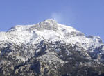 |
 www.maratrail.com |
 www.giovistravels.com |
|
Conocchia and Molare Forestale > Conocchia > Molare
|
This is without doubt one of the most spectacular hikes of the Sorrento Peninsula and Amalfi Coast even though it isn't often that there are all the conditions to make it perfect (in particular the temperature and visibility).
I like to hike this route completing a circuit from Moiano: S. Maria del Castello, Forestale, the steep ascent to Conocchia and then, after having climbed the Molare, down to the cablecar station via Porta di Faito. You then go back to Moiano or Vico by the Circumvesuviana bus, or to Castellammare by cable-car (only from April to October).
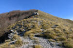
The main climb from the Forestale (763m) to Conocchia (1377m) is completely south-facing and even in early spring it can be extremely hot. Instead some stretches of the higher part of the route are never sunny and you can often find icey ground. Once passing from the southern face to the northern one we registered a temperature drop of 20° C.
Leave the road of S. Maria del Castello at the end of the climb (659m) and take the narrow road (Via Conocchia) going down past a few houses.
After these it turns into a pretty wide, easy and scenic path climbing gently for about half an hour to the Forestale (763m). Just above this stone building is the crossroads: the trail to the right descends to Montepertuso, the central one goes to Capo Muro and Bomerano, the left one climbs steeply up to Conocchia and Molare.
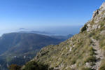
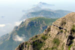
You will zig-zag up to 925m where anyone who isn't afraid of heights or suffers from vertigo can step onto a wide flat rock terrace and enjoy an amazing view. You can also reach this outlook by following the Riva Erbatenera route, not as easy as the Forestale, but similarly spectacular.
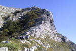
Keep climbing along the east face of the cliff, go past another outlook (1012m) and reach a level path (1075m); follow it to the left for almost 300m and you'll be at the foot of a narrow ridge. There were two signed routes to reach the Conocchia: one along the ridge (steeper and harder, but also more scenic and spectacular - red dots on the map), the other in the valley. Now there is a new trail with steps and railings!!
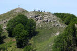
Before you reach the top, turn left leaving the Croce della Conocchia on your right, along an easy path that with some ups and downs (but keeping to between 1360 and 1390m) leads you to the foot of the Molare.
A few meters before you go to the south face of the Molare there is a fork: descending to the left you can go to Agerola passing a few meters beneath the church of San Michele (1268m).
“We highly recommend
the Mt. Faito / Mt. Molare hike. It was an amazing day hike with spectacular
views all along the trail and at the top. The duration was just right: a solid
day, but not overly tiresome. Giovanni routed us so we were hiking in shade a
good amount of the time
(crucial in July, when we hiked).
As for heights, we requested to skip the section with the steepest drop off, so
it was fine. At no point did we feel too high up or anything like that. You'll
be totally fine as long as you tell Giovanni to skip the steep drop-off section.
We originally wanted to hike the Path of the Gods, but took Giovanni's
suggestion to skip that due to the heat and the complication/cost of
transportation. Instead, we did Faito and the hike exceeded our expectations; it
was the perfect trail selection (and getting there from Sorrento is easy/cheap).
Having Giovanni as a guide really enhanced the hiking experience - money well
spent.”


