 |
||||||||||||||||||
 |
||||||||||||||||||
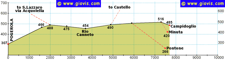
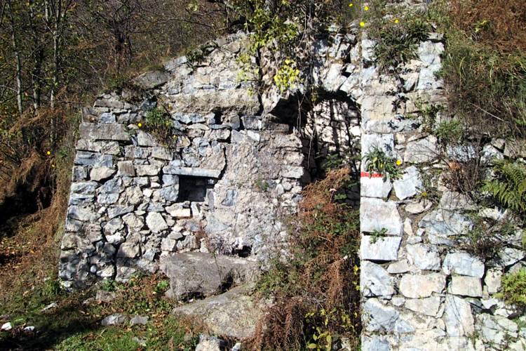
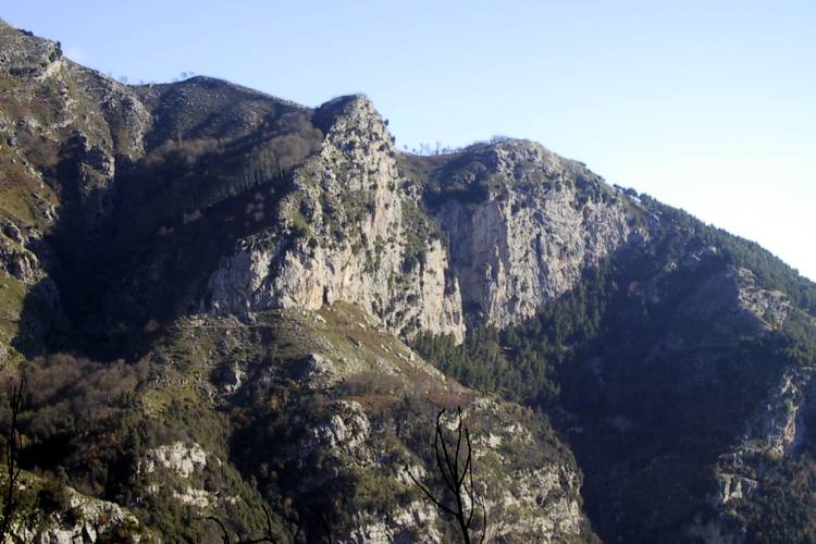
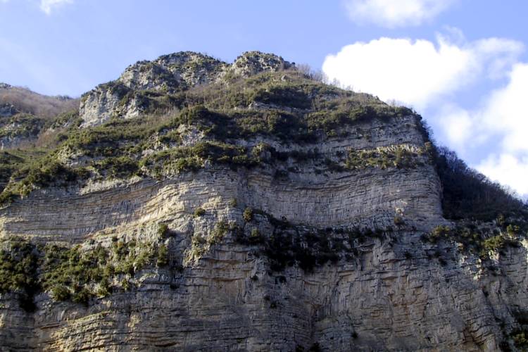
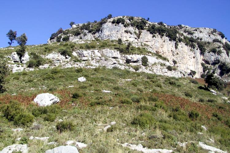
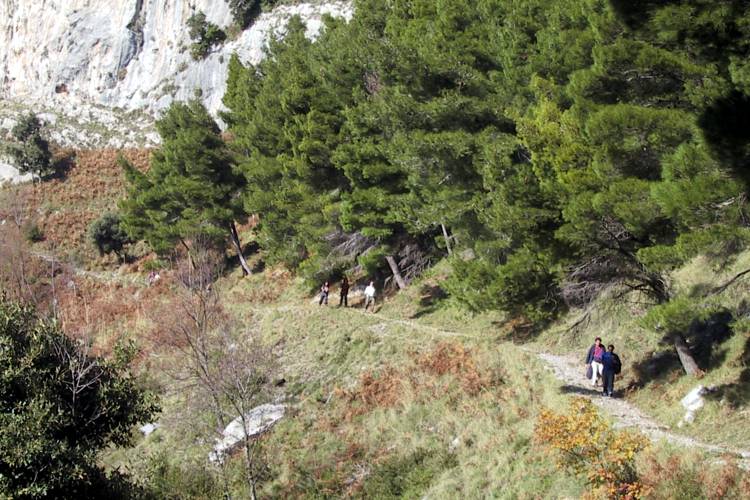
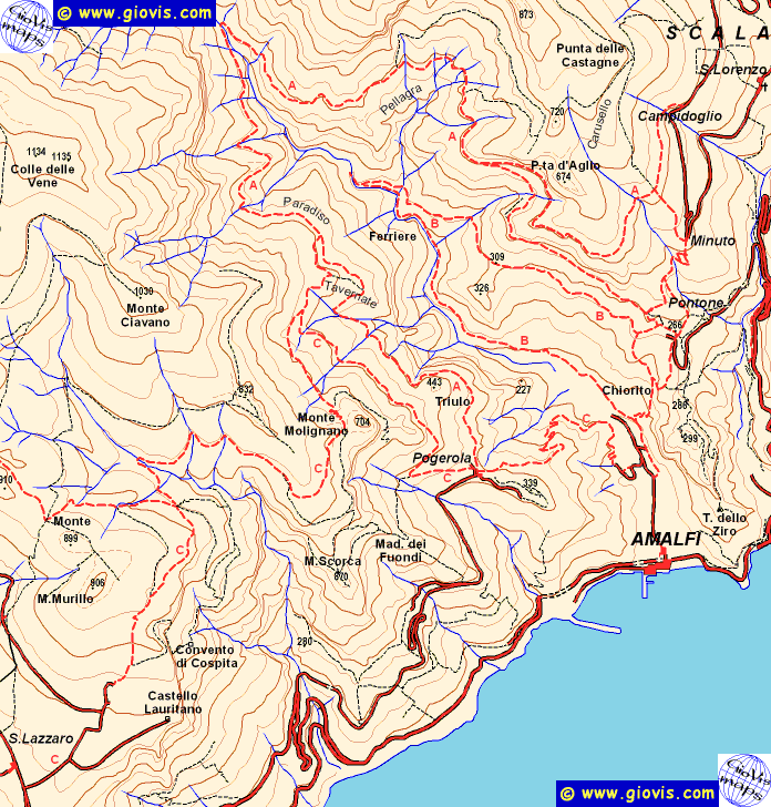
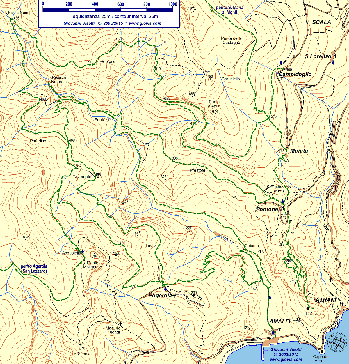
Potete raggiungere Pogerola (307m, frazione di Amalfi), oltre che con mezzi privati, sia con autobus di linea SITA Amalfi - Pogerola sia a piedi da Amalfi lungo un itinerario facile e ben tenuto, seppur tutto in salita e con tante scale (in carta è segnato con la C in quanto tratto terminale del percorso S.Lazzaro > Amalfi). Dopo una eventuale breve deviazione per raggiungere il punto panoramico, dove sorgeva il castello, iniziamo la nostra ascesa verso la parte più interna della valle (in carta sentiero A). Si passa davanti alla Trattoria Rispoli e si prosegue in leggera salita per un paio di km lasciando a destra alcuni ruderi di case coloniche costruite sul ciglio dello strapiombo occidentale della valle. Dopo i ruderi (466m, bel panorama) si percorrono poche centinaia di metri attraverso un castagneto e ci si immette (488m) sul sentiero CAI (segnavia bianco/rossi). Noi proseguiremo diritti in costa, ormai quasi in piano, mentre il sentiero che sale alla nostra sinistra conduce alla sorgente dell'Acquolella e Monte Molegnano e poi prosegue verso Monte Murillo (in carta sentiero C). Il sentiero diventa in alcuni tratti stretto e si dovranno affrontare alcune brevi salite e discese; passeremo accanto ad un paio di cascate di portata molto ridotta, ma con salti notevoli e quindi arriveremo al guado del Rio Canneto (454m). Superato il torrente (di norma c'è poca acqua e non c'è bisogno di bagnarsi) il sentiero diventa più largo e, dopo un breve salita iniziale, rimane più o meno sui 500 metri di quota fin quasi alla fine della nostra escursione. A causa della sua esposizione il versante orientale del vallone è molto meno alberata ed offre ampi e spettacolari panorami. Si continuano a seguire i segni bianco-rossi per un po', ma poi si abbandonano quando li vedremo salire lungo la ripida ascesa verso Castello. Noi continuiamo a seguire l'ampio sentiero lungo il quale corre anche l'acquedotto del Ceraso. Poco prima di raggiungere il grande e ben visibile serbatoio giallo si incontra un bivio (505m): il sentiero che scende a destra conduce a Pontone, da dove si potrà tornare ad Amalfi in appena un quarto d'ora, ma con tanti scalini, o con un percorso più lungo utilizzando il percorso della Valle dei Mulini. Si continua invece in leggera salita aggirando Punta d'Aglio; si attraversa un tunnel scavato nella roccia ed una pineta (c'è una fontanella) e si giunge in vista dei vari villaggi che costituiscono il comune di Scala. Dopo aver abbandonato la pineta, siamo già fra le prime case e giardini e orti ben tenuti. La lunga e ripida scalinata che scende a destra conduce al tornate di Minuta (420m); proseguendo diritto si giungerà invece a Campidoglio (485m). |
|
You can reach Pogerola (307m, hamlet of Amalfi) using your car, by bus (SITA line Amalfi>Pogerola) or on foot from Amalfi along an easy and well kept path, although entirely in ascent and with a lot of steps (on the map it is marked C as it is the final part of the itinerary S.Lazzaro > Amalfi). Before you leave Pogerola you might consider going to the outlook where the castle once was. At the beginning of our ascent (in the map path A) towards the inner part of the valley you pass by the Trattoria Rispoli and then keep going uphill for a couple of km. Along the path you'll pass by some old and ruined country houses (466m) built on the very edge of the cliff offering fantastic views. After a walk of about 200m through a chestnut wood you'll come to the C.A.I. trail (red/white signs). Keep going straight along the hillside whilst the path going up on the left leads to the Acquolella spring and Monte Molegnano before continuing to Monte Murillo (on the map path C). The trail sometimes becomes narrow with some short ascents and descents; you'll pass by a couple of pretty high waterfalls, often dry in the summer and finally you reach the ford across the Rio Canneto (454m). Once past the brook (generally you will be able to jump over without getting wet) the path becomes wider and, a short initial ascent, it remains at an altitude of around 500m almost to the end of the excursion. Due to it being west-facing this side of the valley has a lot fewer trees and consequently more extensive and spectacular views. Keep following the red/white signs for a while but leave them when they start going steeply up towards Castello. Your itinerary continues along the wide path alongside the Ceraso aqueduct. Shortly before reaching the big yellow tank you'll come to a fork (505m); down to the right leads to Pontone. From there you can choose whether to go straight to Amalfi, down lots of steps in just a quarter of an hour, or take a longer route through the Valle dei Mulini (lower trail). Straight ahead the path to Scala continues going gently up around Punta d'Aglio; walk through a short tunnel bored in the limestone and then through a pine wood (drinking water fountain) and finally you'll be in sight of the hamlets that form the commune of Scala. Just after the pine wood, on both sides of the trail you'll see well-kept gardens and orchards and the first houses. The long steep flight of steps going down on your right will lead you to the hairpin bend of Minuta (420m); straight ahead the path goes to Campidoglio (485m). |
||||||||||||||||
|
|
||||||||||||||||||

